How to easily Geotag your Photos with Geotag Photos Pro
Easily geotag your photos with Geotag Photos Pro. This simple, cost-effective app adds GPS data to your images, enhancing your photography experience.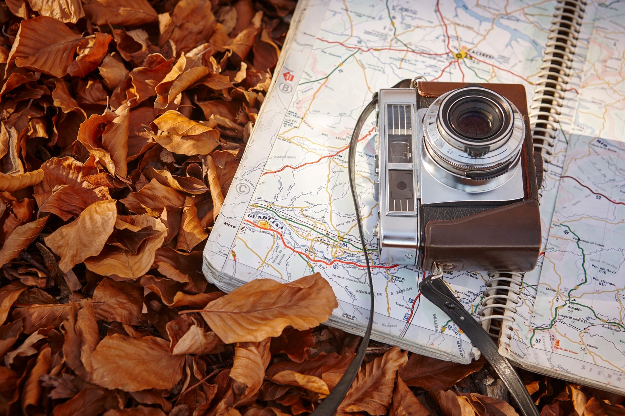
In the age of digital photography, capturing the essence of your travels through photos has never been easier. However, one common frustration for many photographers is the lack of built-in GPS functionality in high-end cameras. While most smartphones and consumer cameras offer this feature, professional cameras often do not.
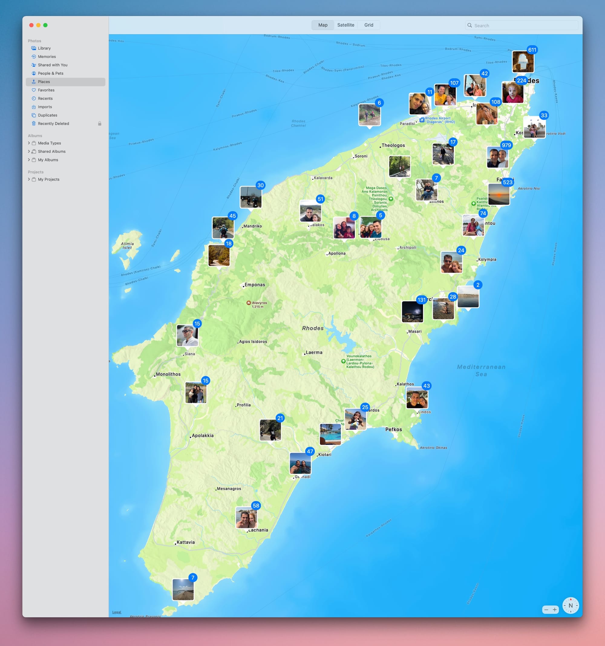
I used to always carry my DSLR when going on trips. However, after my two daughters joined the family, it became challenging to manage all the additional stuff, and the DSLR was the first thing I stopped packing. Now that my kids are older and we don't need to carry as much, I have started bringing my trusted Canon 90D on every trip to pursue my photography hobby. However, I've noticed that most of my trip photos are taken with an iPhone and conveniently organized in the "Places" section of the Photos app, while the DSLR photos are not.
My Canon camera is equipped with an iPhone app that enables it to connect with my phone and utilize it as a GPS, instantly geotagging every photo I capture. However, the connection between the camera and my phone relies on Bluetooth, which makes the entire process quite cumbersome. I often forget to enable this connection before starting to shoot. This is where Geotag Photos Pro comes in. It adds the much-needed solution by allowing me to accurately geotag each photo, regardless of the camera I use.
Why geotagging matters
Geotagging is a valuable tool that adds location data to your photos, allowing you to easily track where each picture was taken. For photographers who enjoy documenting their travels, this feature is essential as it allows you to revisit your journey on a map and share detailed location information with others. Whether you are a professional photographer or a passionate hobbyist, geotagging can improve your workflow by adding a geographical context to your images.
Moreover, geotagged photos can help individuals remember their travel experiences by easily locating specific places they visited. For instance, you can search for the names of places you explored by referencing the location data in your geotagged photos. This is especially useful in recalling the names of restaurants, coffee shops, or landmarks that may have slipped your mind but are captured in your photos.
Introducing Geotag Photos Pro
Geotag Photos Pro is one of those handy mobile apps that make life as a photographer so much easier. It’s designed to add GPS data to your photos without the need for an expensive and clunky separate GPS unit for your camera. The concept is brilliantly simple and straightforward.
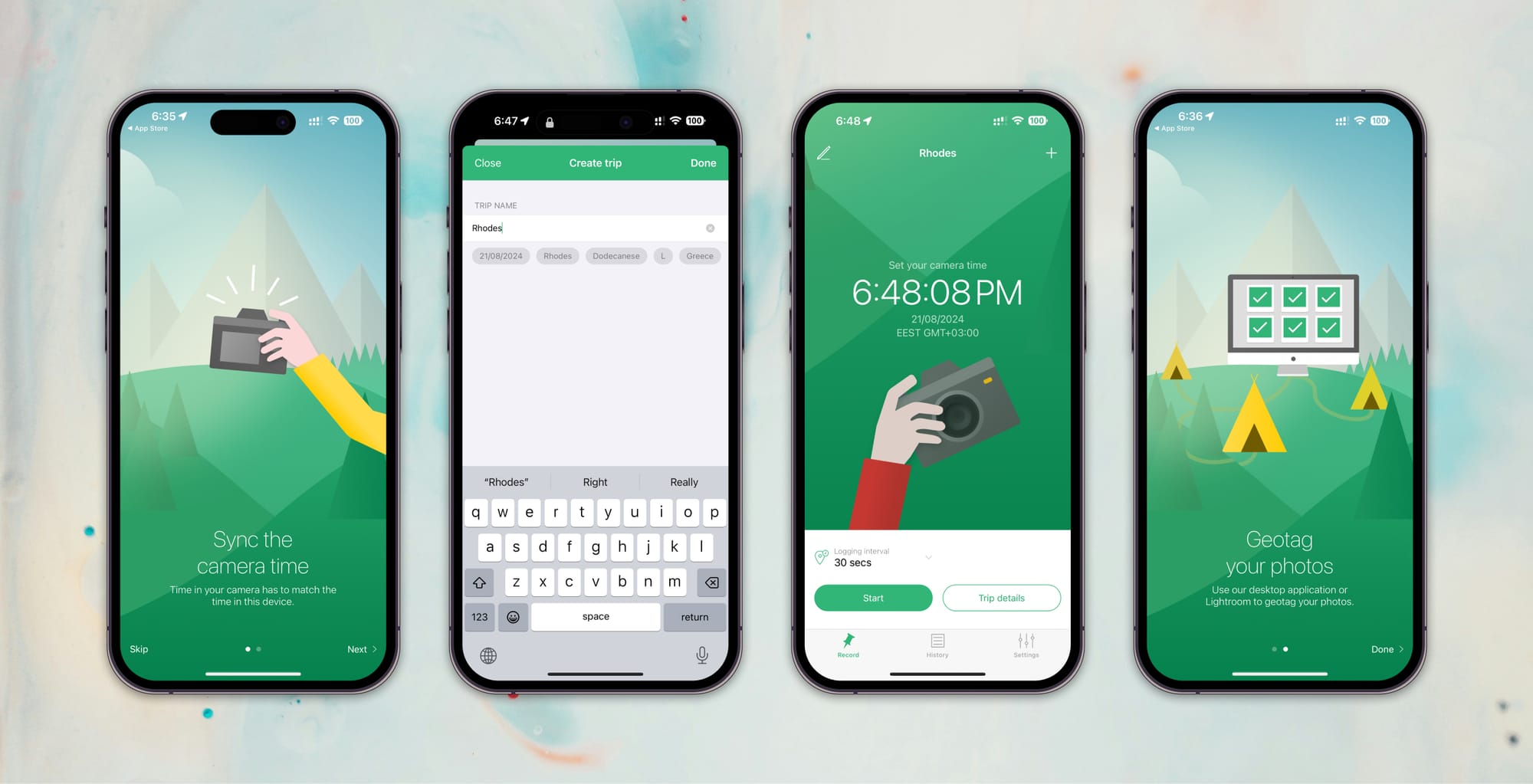
Here’s how it works: First, you sync your camera’s time with your phone—this step is key since it ensures everything matches up later. Then, you open the app and start a new trip. As you go about your adventure, the app quietly records your location at intervals you set, whether that’s every few seconds or every few minutes. It’s like having a personal travel log running in the background, capturing where you are as you move.
Once your trip is wrapped up, the app does something pretty cool: it gives you a .GPX file. You can easily import this file into Lightroom or, if you’re not a Lightroom user, into their companion app. The magic happens when the app matches the timestamps of your photos with the GPS data, adding the correct geotag information to each shot. It’s a seamless way to ensure all your memories are accurately mapped, no matter where your travels take you.
How I use it
Planning a trip means juggling a million little details, and honestly, remembering to start and stop Geotag Photos Pro often slips through the cracks for me. But I’ve discovered a trick that makes it foolproof: as soon as I step out of the house, I hit start on the app, and I don’t worry about it until I’m back home—even if that’s days later. Surprisingly, leaving the app running doesn’t drain my battery much at all, so it’s become a habit. I just let it quietly collect all the GPS data and store it in my iCloud account. When I’m back, no matter how long the trip was, the GPX file has all the location info my photos need.
I stopped using Lightroom a while ago (that’s a story for another time), so once I’m home, I load my DSLR photos into their macOS app (they’ve got a Windows version too). Then, I download the GPX file, and within minutes, my photos are mapped out in the Photos app on my Mac, just like the ones I took with my iPhone. It’s a seamless way to keep all my memories organized and visually connected to the places I’ve been.
Conclusion
Geotag Photos Pro is priced at $12.99, and honestly, it’s worth every penny. If you’re like me and love the idea of adding GPS data to your photos, this app is a game-changer. It’s simple, efficient, and incredibly cost-effective—especially when you consider the alternative of buying pricey GPS equipment for your camera.
Whether you’re a seasoned pro or just someone who enjoys snapping photos on your travels, Geotag Photos Pro makes the whole process of location tagging a breeze. It adds that extra layer of detail to your images, turning them into more than just memories—they become a mapped-out journey you can revisit anytime. If you care about keeping your photography organized and enriched with location data, this app is a must-have.